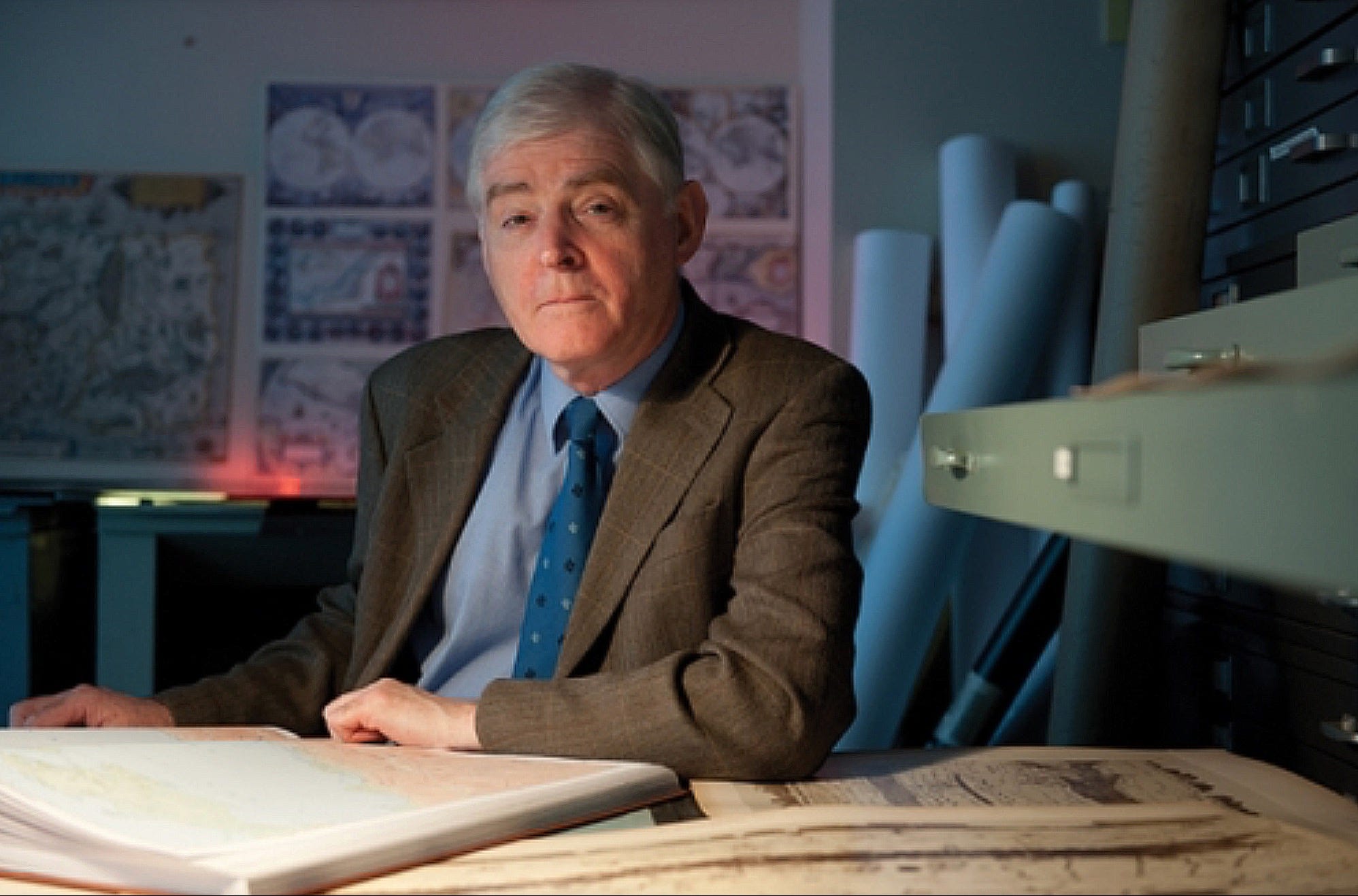
Professor Richard J. Talbert is a renowned British-American ancient historian, and the editor of the Barrington Atlas — a groundbreaking work, drawing together over 200 classicists and cartographers to map the ancient world in its entirety, a feat often dreamt of, but never before brought to fruition. My parents gave me a secondhand copy of the book for my birthday last year, and I was blown away by its scope and detail; at last, I was able to situate all the obscure provincial mints for ancient coins in my collection. I had to reach out to Professor Talbert for an interview, which he very kindly accepted. I asked him about his work with ancient maps, how the Greeks and Romans thought of space and time, and mapping the ancient world — fascinating topics, but little understood, so who better to talk to? Enjoy!
LB: You’ve devoted your career to studying ancient history, from your PhD dissertation at Cambridge about the revival of Greek Sicily (1971) and your award-winning book The Senate of Imperial Rome (1984) to the groundbreaking Barrington Atlas (2000) and recent work on classical conceptions of space. What first sparked your passion for the ancient world, and why do you still find it so fascinating today?
RT: Passion, if that’s the appropriate term here, took time to develop and maintain. In my 1950s English schooling neither Latin nor Greek were choices. Every boy (there were no girls) started Latin aged about 7. At age 10, during a geography (!) lesson, I was one of six ordered to leave that very minute, go to Room wherever, and immediately begin Greek with Mr Innous. So we left, with no explanation offered for the switch. In fact it was because the scholarship exam we were being earmarked to take in three years’ time included a Greek paper, but no geography. Later, when free to make my own choices, I stuck with Greek and Latin for three main reasons. Both (1) were very well taught. Somehow (2) I thrived rising to their challenges – prose and verse composition in particular. And (3) once serious reading of texts began (around age 15), I became hooked. Aristophanes’ Frogs was marvellous (we even staged some scenes), then after I’d spent a miserable Christmas holiday battling through the first 15 sections of the Annals, Tacitus enthralled me.
Even so, at Cambridge the undergraduate language and literature teaching just didn’t fire me up, but ancient history did, so it became my chosen specialism. I even stayed in Cambridge for a PhD when offered the opportunity to work under Moses Finley. He was an American with methods and style refreshingly untraditional by British standards, and a scholar who regarded ancient history as far more than just commentary on classical texts. It was Finley who proposed that I tackle Timoleon, a topic involving inscriptions, archaeology and numismatics along with texts, an ideal training and especially worthwhile for reinterpreting the Corinthian and Sicilian coins. However, even before I’d finished, a prod from Finley landed me a job (in Belfast). So I was thrown into intensive teaching over a wide range, and my next three projects all stemmed from this energizing exposure – Spartan society, a textbook classical atlas, and Rome’s imperial senate. Initially, I never imagined the third of these generating such a hefty book that challenges dismissal of the imperial senate as mere charade.
The far more ambitious atlas project that led to Barrington arose just from a pile-up of accidents. By 1987, the American Philological Association was failing in its efforts to produce a definitive classical atlas. It wanted a fresh vision, with a new project director, so contacted me because by then I had moved to Canada (in 1985) and had actually produced an atlas, modest though it was. For my part, I was blissfully unaware of APA’s abortive efforts. I had only just finished my Sparta Penguin Classic, with no further project yet begun. APA’s invitation intrigued me, so rashly I accepted.
Barrington (published in 2000) opened up an array of exciting new perspectives for everyone, and the Ancient World Mapping Center (which I established) increasingly provided resources and expertise. Ancient worldviews claimed my special attention, with the so-called ‘Peutinger Map’ at the forefront, an iconic Roman image several centuries overdue for reappraisal. Absorption in spatial awareness soon led on to communication widely conceived, time-reckoning, and rich premodern cross-cultural comparisons in partnership with specialists worldwide. Meanwhile advances in digital technology transformed mapmakers’ versatility and released undreamt-of potential. Remarkable discoveries were further stimulus – among them, the Patara stadiasmos and Artemidorus papyrus map, not to mention several portable sundials. All this is why today, yes, I still feel more fascinated and passionate than ever.
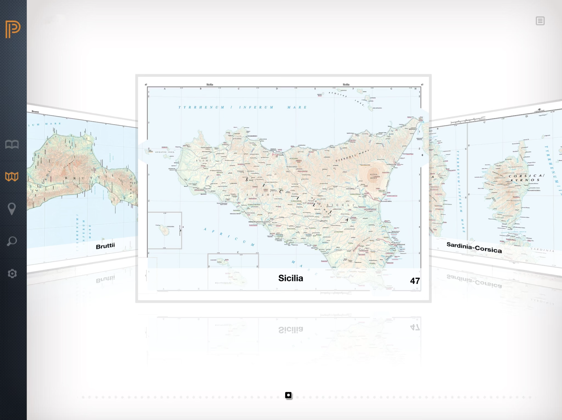
LB: You open the preface to the Barrington Atlas, where you collaborated with over 200 classicists and mapmakers worldwide to map the classical world in its entirety, by stating that it “finally provides an essential tool that everyone with an interest in classical antiquity has sought in vain for a century.” I’m sure nobody would disagree; and in reviews, it’s been described as “the best geography of the ancient world ever achieved.” So, I’m wondering—what major difficulties had earlier mapping efforts struggled with, and how did this one succeed in overcoming them?
RT: Well, of course anybody bold or daft enough to contemplate producing any atlas (print-format the sole option until 21st century) needs to settle upfront the scope and focus of what they’re aiming to represent, along with maximum map-frame size, scale(s), color palette (if any), symbology, etc. At the same time there’s the issue of will the maps use any existing base materials (and if so, how obtained), or will physical landscape in particular be drawn from scratch (and if so, who by ?). Next, who will supply (and by when) whatever’s to be marked on the maps according to detailed specifications that will need drafting. Then, who will lay out everything to create the finished maps (and by when); and who will print, bind and market the atlas, and at what price level. Oh, and not to be underestimated is the little matter of gathering funds to pay for all this ! Production of a complete atlas volume adds an extra headache: obviously you can’t compile the gazetteer, let alone go to press, until all, repeat all, the maps are completed.
In the late 1980s, three ongoing projects stood out as precursors (more or less) of Barrington: the earliest and most relevant (Roman), multi-national from the 1920s; the next (Byzantine), Austrian from 1966; the latest (Near East), German from 1968. All, plainly, were long-term, and in fact even today only the German project has finished (in the 1990s) ! I urged planning rather for completion within a decade at most (so by 1999/2000), after which energy, interest, funds were liable to ebb (the Roman project’s experience). I was also ready to risk aiming for an outsize volume of maps (just maps), designed attractively to engage not only specialists but also the worldwide public with a serious fascination for antiquity. By contrast, all three precursors had opted to issue map sheets intermittently, and to accompany them with dense texts of various kinds. Hence their publications were aimed at specialists, also priced high and feebly marketed. Map design was often disappointing, and scales unduly small.
My conviction was that an APA volume could do far better all round, the more so if it focused on meeting the urgent, basic need which the precursors ignored: namely, coverage of the entire classical world’s physical and cultural (manmade) landscapes – Britannia to Bactria and far up the Nile. Map scales should be ample enough to reflect the grasp of principal features attained by around 1990 (inevitably an uneven grasp). In planning such unprecedented coverage as well as the maps’ design and content, I was blessed to secure the advice and services of the best imaginable team of professional cartographers. For map compilation too, I was able to recruit highly qualified specialists worldwide for all the many different regions, along with peer scholars to critique the drafts submitted. Also, to everyone’s surprise including my own, I did (with help) gradually attract the massive support (several million $) needed to keep production going. The compilers too were all offered $$ in instalments (quite generous amounts). Such inducement made it easier to press them for top-quality drafts, prepared according to my specific instructions and delivered by agreed deadlines ! In short, I possessed resources to exercise control when needed (seldom in fact). This was authority which most notably the director of the Roman precursor lacked – as its maps’ flaws and inconsistencies showed, sad to say.
For sure, regardless of how sound the planning had been or satisfactory its implementation, failure always loomed until close to the end. Crises and stumbling-blocks surfaced relentlessly. But at least by the late 1990s a tipping-point was reached when optimism about the project’s prospects took hold. At APA’s annual meetings during that period the growing number of finished maps displayed year by year was impressive, and thrilling, for all to see. In fall 1999 Princeton University Press promoted the imminent completion handsomely. It offered a tempting prepub price within individual purchasers’ reach (concise metadata on CD-ROM included). In May 2000 the Press oversaw superb printing and binding in Italy. So yes, an immense international collaborative success – with wonderful, generous help forthcoming for all its aspects, repaying 12 years of fearsome risk and struggle. Even so, still something of a lucky outcome, not to say miraculous.
LB: Let’s say you’re curating a small exhibition exploring how the Greeks and Romans understood the world around them. Which object do you choose as the highlight, and why?
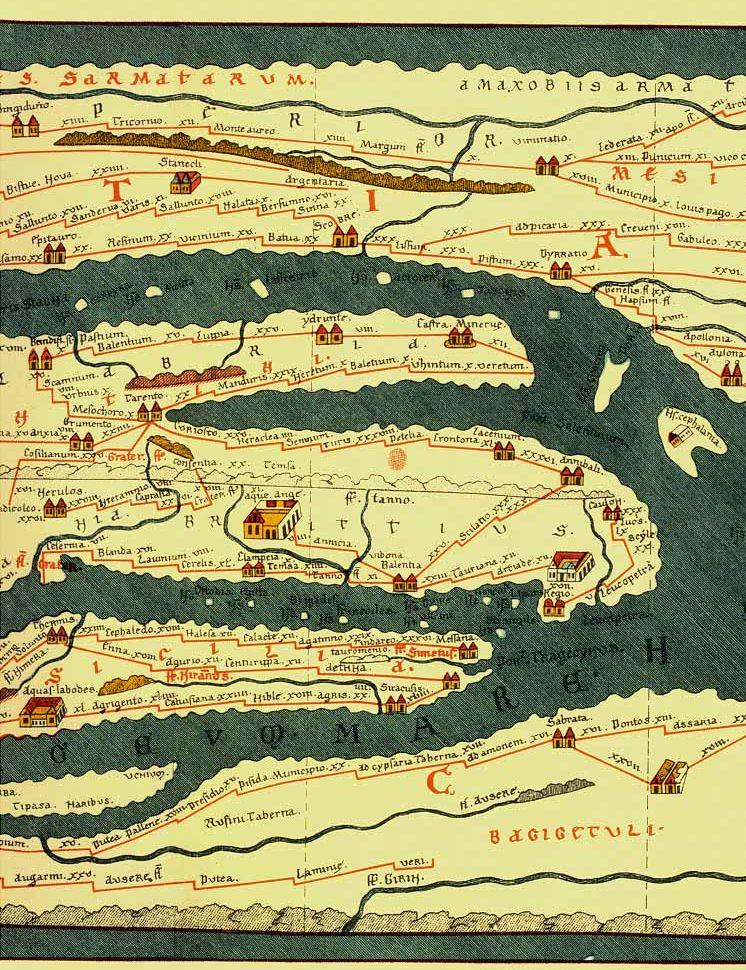
RT: One highlight only ? Then I suppose it just has to be the Peutinger Map, because this offers such an absorbing (and puzzling), comprehensive, colorful Roman worldview – extending, even minus its now-lost western end, to 6.7 m / 22 ft. wide/long ! Quite a knockout for anyone encountering it for the first time, such a display of cities, peoples, rivers, islands, spas and much more. Roads/routes feature conspicuously, so if you enjoy (re)creating land journeys, you’re offered limitless opportunity here. How about devising an itinerary from Tolosa (Toulouse, France) to Cesiphun (Baghdad, Iraq) ? But whatever the traveler in you dreams, I strongly advise Do Not Attempt To Drive With This Map.
If the small exhibition envisaged can’t accommodate the unwieldy long Peutinger Map, then I suggest one or other of the following two objects, even both perhaps because each really is small:
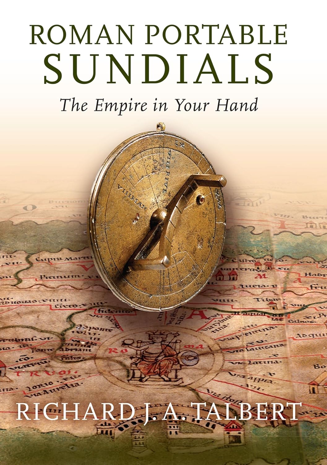
First, a ‘geographical’ portable sundial that can tell you the time (when there is sun) – the day being divided into 12 equal hours. Hence the length of each hour varies by season and according to your latitude. Ingenious craftsmen devised hand-size bronze sundials that could be adjusted to work at almost any latitude. By the mid 2nd century CE Ptolemy at Alexandria had hit upon a neat, user-friendly format for stating latitude figures, so portable sundials then came to be made with a set of city or province/region names inscribed on the bottom in Greek or Latin, each with its latitude figure. Whoever was paying for the sundial could choose the names; space for around 30 was the norm. So what emerges from these sets of names are individuals’ worldview, because there’s no standard one-size-fits-all set. The names can be a mix of places the individual visits periodically (so it seems); and/or had made a single memorable visit to without expecting ever to return (say, to Carthage); or dreamt of visiting, but couldn’t really expect to (say, to Babylon or Ethiopia); or felt just ought to be included as key ‘anchor’ points (such as Alexandria, Constantinople, Rome). Even the order in which the names appear can prove instructive. It may reflect latitude order, or successive stops on an (imaginary) land and sea journey, or be hardly more than a jumble. Often the latitude figures stated are inaccurate, some dreadfully. So if you map out every name on a sundial using them, the geography can become a real mess (Africa north of Spain, for example, Cappadocia just south of Judaea). But evidently no-one was much bothered !
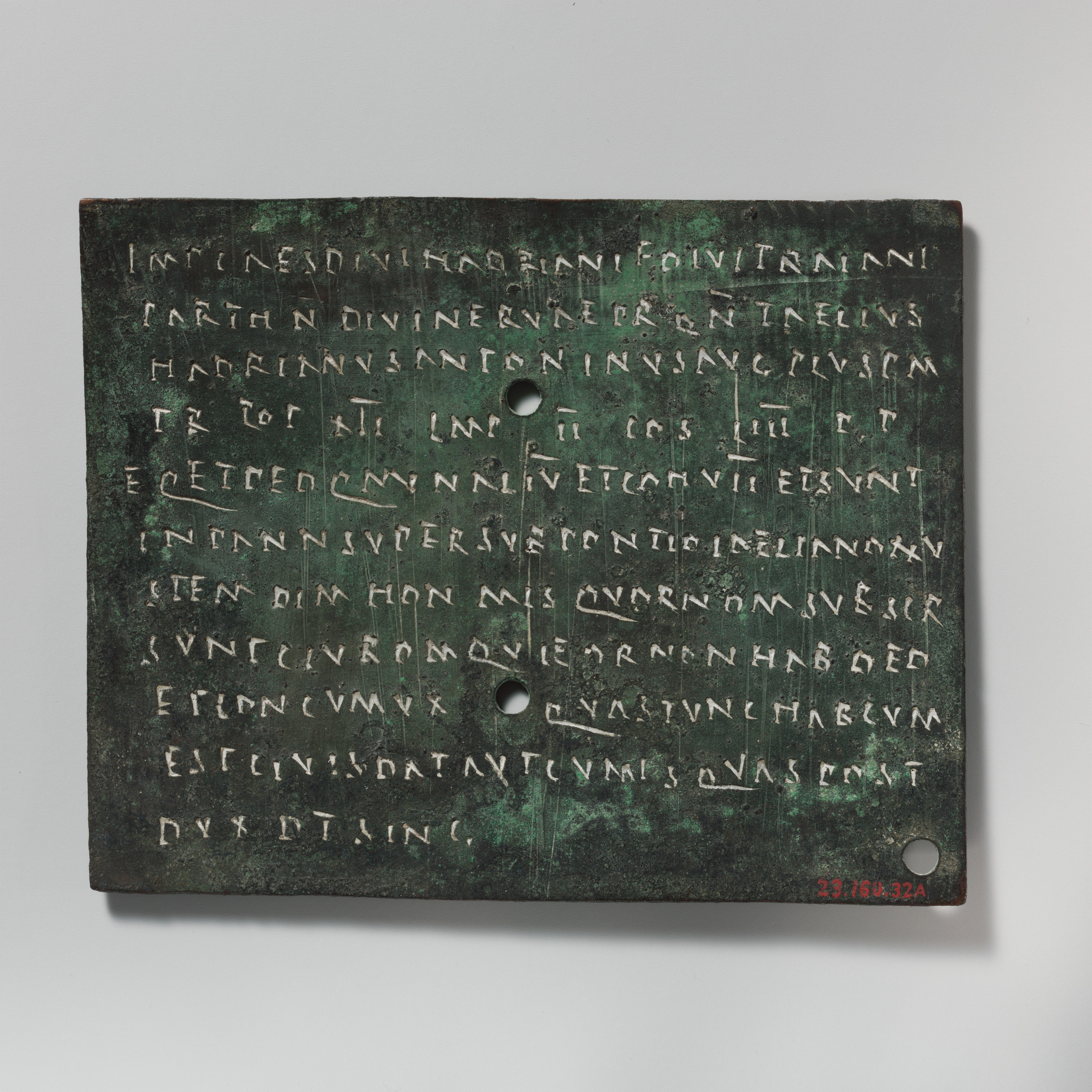
A second small object worth highlighting is one of the so-called diplomas presented to Rome’s volunteer sailors and auxiliary-grade soldiers if/when they completed 25 years’ good service and were discharged. These compact Latin documents, inscribed on bronze, were issued roughly between the mid-first century CE and the early third century. Typically, the men who receive them now gain Roman citizen status (which most didn’t have when recruited), and also the right to bestow on one spouse (only one !) a status which will make the children of the marriage Roman citizens too. If a man already has a partner who he now wants recognized as that spouse, she can be named in his diploma. So too can any children already born that he recognizes as his, because they can now receive Roman citizenship retrospectively. If all this sounds a tad complex, yes, it might well be; the basic problem was that a Roman soldier could not be legally married during service. For the exhibition, however, I recommend sidelining the legal and social aspects. Underline instead that each diploma is unique to a particular individual, and that we can form an impression of his worldview even from the scant information recorded about himself and dependents. Let me illustrate from the recipients of two diplomas.
The first man received his diploma in 105 in the Roman province of Moesia (south of the Danube in eastern Europe). His origo in Latin – ‘origin’, community or people of his birth – is stated as the Dobunni people, which makes him a Brit from the Gloucester area. How his military career developed, we haven’t a clue, but we do know that, before being moved to Moesia, his unit was based in central Europe, in the province of Pannonia. It was here presumably that he met the spouse his diploma names, a woman of the Azali people in the Budapest area. His diploma was found at ancient Brigetio, no great distance west of Budapest. So we may infer that after his discharge in Moesia they went back to her family’s area, not to his far further west in southern England. What sort of worldview had this soldier formed during his long service ? Clearly he had traveled from Britain at some stage, certainly he knew the Danube well, and no doubt the Rhine too to a lesser extent. I guess he had never been to Rome, but even if not, he must still have gained some comprehension, however sketchy, of Rome’s empire along the great arc from Britain to the Black Sea.
The second man was a sailor in the Roman fleet based at Misenum (on the west coast of Italy, in the Naples area today, where Puteoli was the major ancient city). He received his diploma in 229. His origo is precise: a village in the vicinity of Claudiopolis (Mut today), a city in the province of Cilicia (south-east Turkey). A spouse is named, whose origo is stated as ‘African’, though that needn’t mean they met in Africa. Africans were settled in and around Puteoli, so this could have been her home. He quite possibly did visit Rome itself, because squadrons from the Misenum fleet were often dispatched to the harbors at the river Tiber mouth. No doubt he was stationed in Caria (south-west Turkey) when their second son was born, because he was named Caricus. But by the time a third son arrived, our sailor was presumably back in Italy at home-base, because this son was named Puteolanus, after the city close to Misenum. In all likelihood, after his discharge our sailor and spouse went back to his home region, because his diploma was found in central Turkey (in the Konya area). From his voyages he must have gained a fair impression of the Mediterranean eastward from Italy and Sicily through the Aegean, and perhaps touching Crete and North Africa, all the way to west and south Asia Minor – quite an eye-opener, it would seem, for a lad born well inland.
LB: If a Roman had access to 21st century cartography—say, a satellite map of the Mediterranean—for a day, what do you think would surprise them most?
RT: Nice fantasy question, but difficult to tackle without you first answering a related question: “What level of education and intellectual curiosity does this Roman have who’s being offered access to modern cartography ?” It’s essential to know, when most people in the Roman empire were illiterate and would never see any map at all – except possibly one of local landholdings. Most people would be like the comedy character Strepsiades in 5th century BCE Athens, whose reactions to a map of Greece Aristophanes ridicules in his Clouds. In real life barely more than a century ago, it was locals like Strepsiades that the young, well-educated mapmaker/explorer Guillaume de Jerphanion encountered upcountry in Pontus (north-east Turkey). He laments: “It’s difficult to obtain from mountainfolk the precise information one wants.” And when he realizes that locals along successive stretches of the same river give it different names, he laments again: “There’s nothing fixed about geographic names in Asia Minor.” No, because here, as ever, most people’s worldview was pretty much just local.
For sure, some Greeks and Romans did make maps, and with growing skill once Eratosthenes at Alexandria (3rd century BCE) had devised the latitude and longitude grid still in use today. But these maps never became standard reference tools. Such schools as there were (only for fee-payers, needless to add) focused on rhetoric and literature. Geography was seldom part of the curriculum. So map consciousness never developed. Maps simply weren’t used even by emperors, governors, generals or their staffs. I suspect that if you showed them a satellite map of the Mediterranean, they’d react as the Japanese did in the 16th century when Europeans proudly showed off their mechanical clocks. The Japanese found them fascinating, but useless. They already had their own system for dividing up the day and marking its successive stages. European clocks related to a different system, one which the Japanese had no interest in adopting. Similarly, while most educated Romans might acknowledge a satellite map of the Mediterranean to be ‘interesting’, I doubt they’d linger over it, because they just weren’t wired to conceptualize space with the use of maps.
Only the tiny number of mapmakers are likely to have lingered, and by (say) the 1st century CE there probably wouldn’t have been much about the Mediterranean itself to surprise them. They already had a reasonable grasp here. However, if your image also extended a good way north, I’m sure they’d be grateful and surprised to gain their first accurate impression of Europe from the Danube on up through Scandinavia. Pliny the Elder makes brief mention of Scandinavia in the geographical section of his Natural History, but he admits to ignorance. He thinks it’s one of many islands, though has no idea of its size, and sums it up honestly as “another world.”
LB: Finally, if you could have dinner with any three geographers or map-makers from the ancient world, who would you choose, what would you eat, and what would you ask?
RT: Delighted to host the dinner party you propose, thanks for the opportunity. It’s hard to pick just three geographers or mapmakers, but given the interests I’ve developed in my researches, I’ll invite the following please, listed in chronological order:
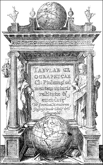
First – and the only one of the three whose name we know – Marinus, said to be from Tyre (in Lebanon), and active around 100 CE, it seems. All his writings and maps are lost. We know of them only from Ptolemy’s discussion of his work about half a century later. It is in the Alexandrian tradition begun by Eratosthenes, and Ptolemy does not hesitate to criticize it harshly. Yet there can be no mistaking the fact that, even so, Ptolemy owes a great deal to it. I’m sure it would be worth learning from Marinus himself.
Second, the individual (man ?) who headed the team that designed and produced the so-called Marble Map of Rome around 200 CE. This was a dramatic monument about 13 metres wide by 18 tall, comprising 150 marble slabs clamped to one endwall of a long interior space just by Rome’s Forum. Believe it or not, the wall itself survives to this day. Although only 10 per cent or so of the slabs have been recovered, these inscribed fragments are astonishing and can at last (since 2024) be viewed in their own Forma Urbis museum. They present imperial Rome at the very generous scale of 1:240, large enough to show ground-floor rooms and even doorways and individual columns – a staggering level of detail. It would be fascinating to hear how all this was achieved, and on whose orders.
Third, another team-leader, the man (?) who designed and supervised the creation of the so-called Peutinger Map that I’ve already mentioned, probably sometime during the 4th century CE. Here too there’s a most revealing tale of design and production waiting to be told. I’m eager to ask about the part(s) of the original map now lost. We possess only an incomplete medieval copy on parchment, and there’s been lively speculation about what more of the map there once was. Was it originally presented on parchment ? Also, who commissioned it, and for what setting ? There’s linkage with Marinus here, because the map’s layout of the Roman world – boldly distorted though it is – has to be based on Alexandrian-style cartography. What will Marinus’ reaction to the Peutinger Map be, I wonder ?
While optimistic that the dinner is likely to prove memorable anyway, I would still hope for a hostess as partner in assuring its success. So may I also invite the indefatigable Christian pilgrim and traveler Egeria to take this role (her name, incidentally, is not certain) ? She hails from somewhere west of the Rhône, and must have upper-class poise because she hobnobs effortlessly with high-ups, loves chatting up men, and makes no secret of her inquisitiveness – an ideal social lubricant therefore (late 4th century CE). I suspect that, like me, she’s no foodie fanatic, so wouldn’t want dormice or crane served. Regular Mediterranean-diet fare will do fine – much naturally depending on where the dinner takes place and at what season. Some fish would be a pleasure. The sole foodie remark in Egeria’s travelogue is that the great big fish (carp) filling King Abgar’s pools at Edessa (Şanlıurfa in Turkey today) are boni saporis. So if we happen to be thereabouts, let’s try these, and be sure to have pepper among our condiments to remind us of Rome’s wider world.